Click Here to View This Page on Production Frontend
Click Here to Export Node Content
Click Here to View Printer-Friendly Version (Raw Backend)
Note: front-end display has links to styled print versions.
Content Node ID: 405359
Given the satellite data and forecast models of the 21st century, you might think that weather wouldn’t present much of a problem to the modern pilot. But Mother Nature remains unpredictable, and pilots flying certain missions sometimes still face challenging weather.
Consider the scenario of a helicopter emergency medical services (HEMS) team called to the scene of an auto accident in which inclement weather was a factor. While the HEMS crew uses various sources of aviation weather data to determine whether it is safe for the aircraft to launch, conditions can change dramatically from the time when weather information was obtained until the time of the flight. In an FAA review of 27 fatal commercial HEMS accidents from January 1998 through December 2004, 16 operations began under visual flight rules but ended tragically when the pilots inadvertently flew into instrument meteorological conditions (IMC) at night, resulting in controlled flight into terrain.
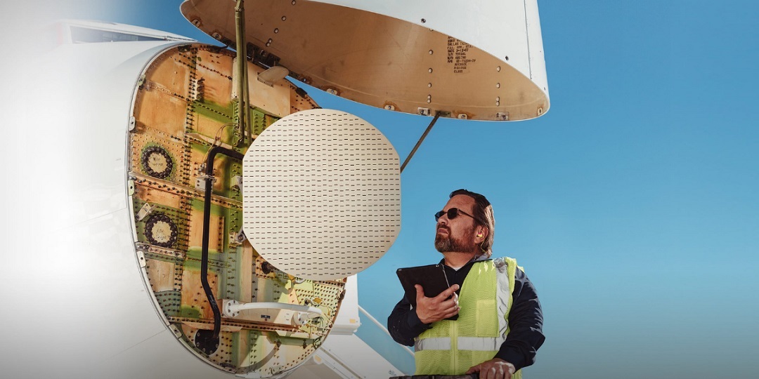
Honeywell’s IntuVue RDR-7000—the newest, lightest, and most technically advanced in the company’s long line of airborne weather radar systems—provides real-time weather information that can help HEMS and other mission-oriented pilots make better routing decisions while in the air.
Weather and Terrain Tools for First Responders
The IntuVue RDR-7000’s small footprint and light weight—about 14 pounds compared with the 45-pound version for airliners—makes it ideal for helicopter operators who need precise real-time weather data. Honeywell’s RDR-7000 high-resolution weather radar system uses solid-state transmitters and pulse compression for reduced weight and power consumption, advanced processing, and increased reliability over magnetron-based transmitters. Combined, this technology results in extremely accurate real-time information with a minimum of pilot intervention.
“Weather is difficult to predict, and pilots continually risk encountering unexpected weather like hail or thunderstorms, which can impact the safety and comfort of all onboard,” said Stevan Slijepcevic, president of Honeywell Aerospace Electronic Solutions. “The RDR-7000 reduces this risk by more than 50 percent using the new and improved automated mode, which helps pilots focus on upcoming weather hazards and reroute decisions instead of operating the radar.”
Unlike conventional weather radars, which scan only a portion of the sky and require pilot input to control radar tilt and gain, the RDR-7000 automatically scans the entire volume of air in front of the aircraft from the ground to 60,000 feet and up to 320 nautical miles ahead. The onboard software uses the 3D volumetric scans to analyze any clouds for conditions that might produce lightning, hail, turbulence, or wind shear and displays their location and height to the flight crew.
“The Honeywell RDR-7000 performs a scan, then increases the tilt by 1 degree and does another, rapidly repeating the procedure from 0 to 60,000 feet,” said Slijepcevic. “Consecutive scans at different tilt angles capture a series of overlapping slices that are pieced together to form a three-dimensional picture. It’s the key technology breakthrough in airborne weather radar.”
One key feature of the RDR-7000’s automatic mode is the ability to clearly depict on-path versus off-path weather, cross-hatching out weather more than 4,000 feet above and below the aircraft’s flight path to give the pilot a clearer picture of relevant information. The system also provides tactical audio and text notification of significant on-path weather out to three minutes ahead. In vertical profile mode, pilots can choose to view weather along the aircraft’s current track, an alternative track, or the track as defined by the flight plan.
The vertical display also presents a profile of upcoming terrain, another feature that separates the Honeywell system from others. Using its internal terrain database—similar to the database used by Honeywell’s Mark XXII Enhanced Ground Proximity Warning System (EGPWS)—the RDR-7000 not only displays upcoming terrain but also eliminates nearly 100 percent of ground returns that often impede the accuracy of early weather radar systems.
While HEMS pilots generally deliver their patients to medical facilities with cleared helipads, often they must pick up patients in improvised landing zones that may not be much larger than the helicopter itself or may contain obstacles, often at night and in poor visibility. Honeywell’s Mark XXII EGPWS uses robust databases that cover 100 percent of the world’s terrain—including more than 120,000 man-made obstacles—to present a real-time display and terrain alerts. Coupled with EGPWS and synthetic vision systems, the RDR-7000 onboard weather radar can provide the situational awareness needed for the aircrew to feel more confident about their flight in such challenging conditions. This confidence is often transmitted subconsciously, and sometimes deliberately, to HEMS patients and other passengers to help ease their anxiety.
Maritime Surveillance Mode Provides Additional SAR Tool
The Honeywell RDR-7000 provides an additional tool for search-and-rescue (SAR) personnel operating over water: they can use its maritime surveillance mode to detect and track multiple seaborne vessels. The radar’s target-display symbology, sea-clutter reduction, and sector-scan features can also enhance the effectiveness of maritime SAR operations.
“The RDR-7000 is the only weather radar in its class that offers both maritime surveillance and advanced weather-detection capabilities,” said Slijepcevic. “As a next- generation, high-resolution weather radar system with fully automated tilt and gain controls and airborne ground/sea mapping system, the RDR-7000 ensures accurate and timely aeronautical decision-making with comprehensive weather detection and avoidance capability.”
Other operators who would benefit from RDR-7000’s maritime mode include offshore oil and gas producers. The RDR-7000 is fully compliant with the airborne weather radar requirements outlined in AC 90-80C Offshore Standard Approach Procedures (OSAP). Advanced features such as target-display symbology and sea-clutter reduction can help crews quickly clear the approach area for obstructions and identify the target landing site when executing an OSAP procedure in IMC.
In addition to detecting turbulence up to 60 nautical miles ahead and the presence of hail and lightning up to 160 nautical miles in front of the aircraft with up to 93 percent accuracy, the RDR-7000 can warn the low-flying helicopter rescue, EMS, or oil and gas crew of a more insidious danger: wind shear. While many major airports have low-level wind-shear (LLWS) detectors installed and warn pilots through ATIS or other means, helicopter pilots performing off-airport operations generally don’t have any LLWS warning tools. By calculating and comparing wind speeds, the RDR-7000 can predict wind shear five to 10 nautical miles in front of the aircraft.

Real-time Weather for Corporate Aircraft
Bombardier Global XRS captain Stephen Hartley is no longer surprised by the weather. Before charter company ACI Jet upgraded the business jet’s avionics to include the RDR-7000 in mid-2020, Hartley sometimes found himself flying into weather that he would rather avoid.
“Once I was flying in Florida at night and the radar was painting almost nothing,” Hartley said, referring to the previously installed non-Honeywell radar. “Suddenly, I found myself entering an active storm cell, getting rained on and beat up by turbulence. Fortunately, everything came out OK, but obviously it would have been better to have a weather radar system that provided real-time warning that I was approaching a storm front.”
Hartley flew the 14-passenger XRS for two years before the RDR-7000 was installed for a series of flight tests that assisted Honeywell in attaining the technical standard order (TSO) authorization for the system in July 2020.
“We really put the radar through its paces throughout the two-week flight-test regimen,” he said. “We actually went hunting for storm systems so we could see how well the radar paints thunderstorms, lightning, hail, and turbulence at long distances and various altitudes…I’m looking forward to flying the RDR-7000 on my next flight from California to Europe or Asia. I can’t imagine flying a long haul over water without it.”
Using the RDR-7000 can decrease an airline or corporate flight department’s operational costs by reducing delays and downtime due to flying into hail, wind shear, and other weather incidents. Its accuracy also allows pilots and dispatchers to optimize routes around weather and reduce diversions and turn-backs, resulting in time, fuel, and cost savings. More accurate weather information additionally results in less turbulence, preventing the occurrence of turbulence-related repair costs and even passenger injuries.
Besides the real-time accuracy and depth of weather information, Hartley likes the simplified controls and automatic operation of the RDR-7000. “[The RDR-7000] has fewer controls, is easy to operate, and does most of the work for you,” he said. “Pilots don’t have to do a lot of mental calculations and manual operations that can distract them from managing the aircraft. It does everything it’s supposed to do, so I think pilots are going to really want this radar. It’s sort of a no-brainer.”