Click Here to View This Page on Production Frontend
Click Here to Export Node Content
Click Here to View Printer-Friendly Version (Raw Backend)
Note: front-end display has links to styled print versions.
Content Node ID: 403147
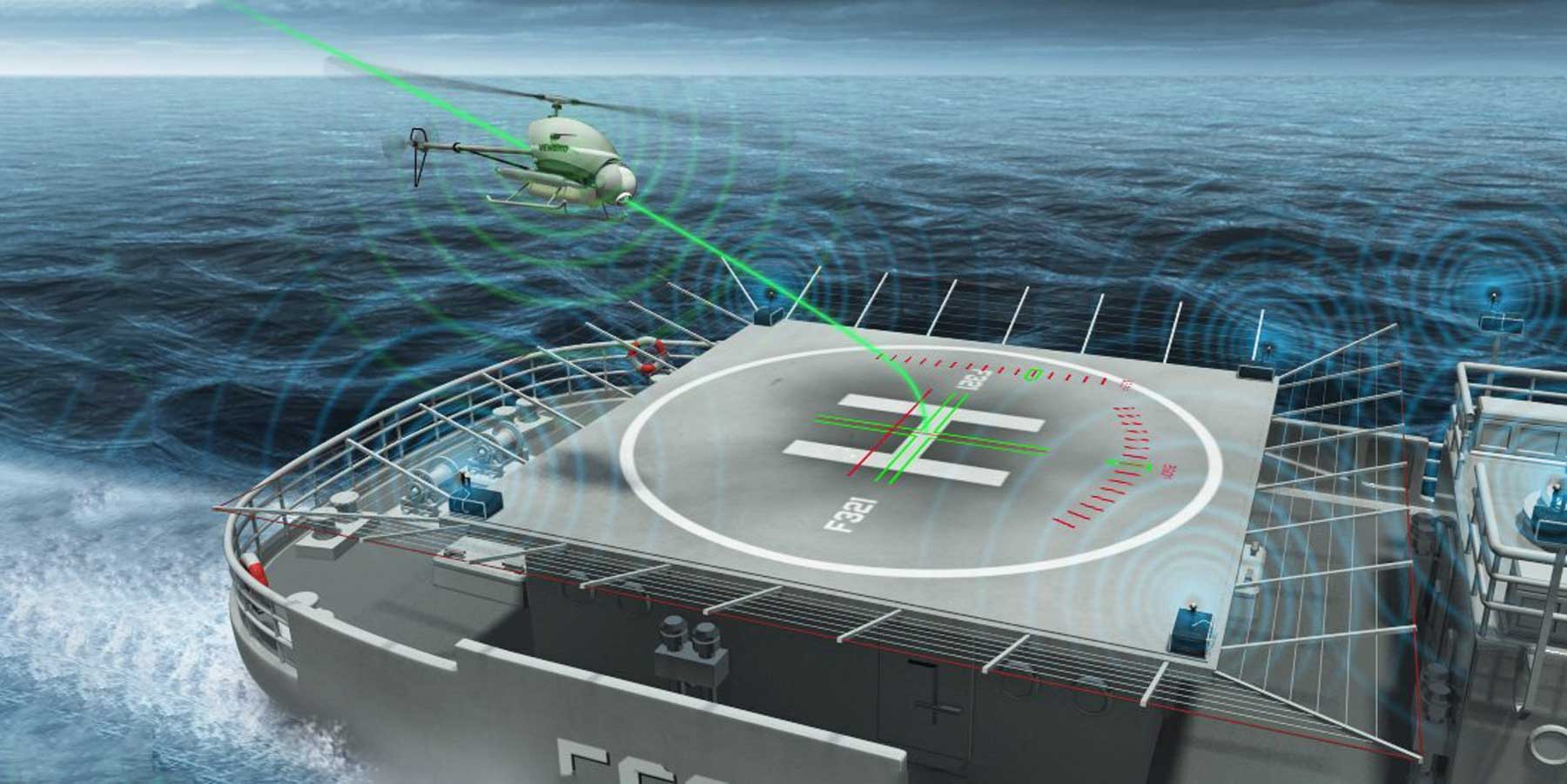
The Airbus VSR700 optionally piloted vehicle (OPV) recently made fully autonomous takeoff and landing (ATOL) approaches to and from a DeckMotion moving platform simulator—a pitching, yawing surface, mounted on a trailer to simulate the conditions of a moving ship deck. The small rotorcraft, derived from the Helicopteres Guimbal Cabri G2, used Airbus’s DeckFinder technology to locate and interface with the DeckMotion simulator.
DeckFinder has applications for the offshore fossil fuel and wind energy markets. “DeckFinder transmits the platform’s position in real-time to the OPV’s automatic pilot with a very high level of accuracy, which cannot be achieved with classical positioning equipment like a GPS. This accuracy is crucial to achieve the final phase of the approach and the landing on a moving reference like a ship deck to enable the landing,” said VSR700 program director Nicolas Delmas. 
DeckFinder’s positioning sensor supports naval operations with positioning accuracy of just more than 20 cm. The system has an update rate of 33 Hz and a scalable operation area up to 300 meters.
DeckFinder’s three segments work in triangulation. The ground segment includes the components installed on the landing spot, an airborne segment corresponds to components on the aerial vehicle itself, and a monitoring and software control segment updates the vehicle’s position on a flight display or the data interface. The system works with multilateral, independent RF-based ranging signals.
Distance measurements are done in a license-free RF band that is independent from the Global Navigation Satellite System (GNSS). DeckFinder determines the range between the ground station antennae and the airborne segment antennae with a high accuracy in a local area. The system overcomes GNSS performance and resultant autopilot limitations in GPS-shaded environments, mainly near offshore platforms and in urban and mountain areas, as well as supporting landings thunderstorms, blizzards, or dense fog.